


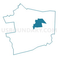
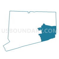
Preston 1 Voting District, New London County, Connecticut
About
Outline

Summary
| Unique Area Identifier | 550108 |
| Name | Preston 1 Voting District |
| County | New London County |
| State | Connecticut |
| Area (square miles) | 31.74 |
| Land Area (square miles) | 30.82 |
| Water Area (square miles) | 0.93 |
| % of Land Area | 97.08 |
| % of Water Area | 2.92 |
| Latitude of the Internal Point | 41.51865230 |
| Longtitude of the Internal Point | -72.00659730 |
Maps

Graphs
Select a template below for downloading or customizing gragh for Preston 1 Voting District, New London County, Connecticut


Neighbors
Neighoring Voting District (by Name) Neighboring Voting District on the Map
- Griswold 2 Voting District, New London County, CT
- Ledyard 1 Voting District, New London County, CT
- Ledyard 2 Voting District, New London County, CT
- Lisbon 1 Voting District, New London County, CT
- Montville 2 Voting District, New London County, CT
- North Stonington 1 Voting District, New London County, CT
- Norwich 10 Voting District, New London County, CT
- Norwich 5 Voting District, New London County, CT
- Norwich 6 Voting District, New London County, CT
Top 10 Neighboring County Subdivision (by Population) Neighboring County Subdivision on the Map
- Norwich town, New London County, CT (40,493)
- Montville town, New London County, CT (19,571)
- Ledyard town, New London County, CT (15,051)
- Griswold town, New London County, CT (11,951)
- North Stonington town, New London County, CT (5,297)
- Preston town, New London County, CT (4,726)
- Lisbon town, New London County, CT (4,338)
Top 10 Neighboring Place (by Population) Neighboring Place on the Map
Top 10 Neighboring Elementary School District (by Population) Neighboring Elementary School District on the Map
Top 10 Neighboring Unified School District (by Population) Neighboring Unified School District on the Map
- Norwich School District, CT (40,493)
- Montville School District, CT (19,571)
- Ledyard School District, CT (15,051)
- Griswold School District, CT (11,951)
- North Stonington School District, CT (5,297)
Top 10 Neighboring State Legislative District Lower Chamber (by Population) Neighboring State Legislative District Lower Chamber on the Map
- State House District 46, CT (25,434)
- State House District 47, CT (24,901)
- State House District 45, CT (24,378)
- State House District 43, CT (23,842)
- State House District 42, CT (22,948)
Top 10 Neighboring State Legislative District Upper Chamber (by Population) Neighboring State Legislative District Upper Chamber on the Map
Top 10 Neighboring 111th Congressional District (by Population) Neighboring 111th Congressional District on the Map
Top 10 Neighboring Census Tract (by Population) Neighboring Census Tract on the Map
- Census Tract 7011, New London County, CT (7,691)
- Census Tract 7012, New London County, CT (7,356)
- Census Tract 7091, New London County, CT (6,322)
- Census Tract 6964, New London County, CT (6,052)
- Census Tract 6967, New London County, CT (5,915)
- Census Tract 7071, New London County, CT (5,297)
- Census Tract 6970, New London County, CT (4,768)
- Census Tract 7001, New London County, CT (4,726)
- Census Tract 8705.01, New London County, CT (4,470)
- Census Tract 7101, New London County, CT (4,338)
Top 10 Neighboring 5-Digit ZIP Code Tabulation Area (by Population) Neighboring 5-Digit ZIP Code Tabulation Area on the Map
- 06360, CT (37,541)
- 06351, CT (16,301)
- 06382, CT (11,947)
- 06339, CT (8,302)
- 06335, CT (6,729)
- 06359, CT (5,313)
- 06365, CT (4,720)